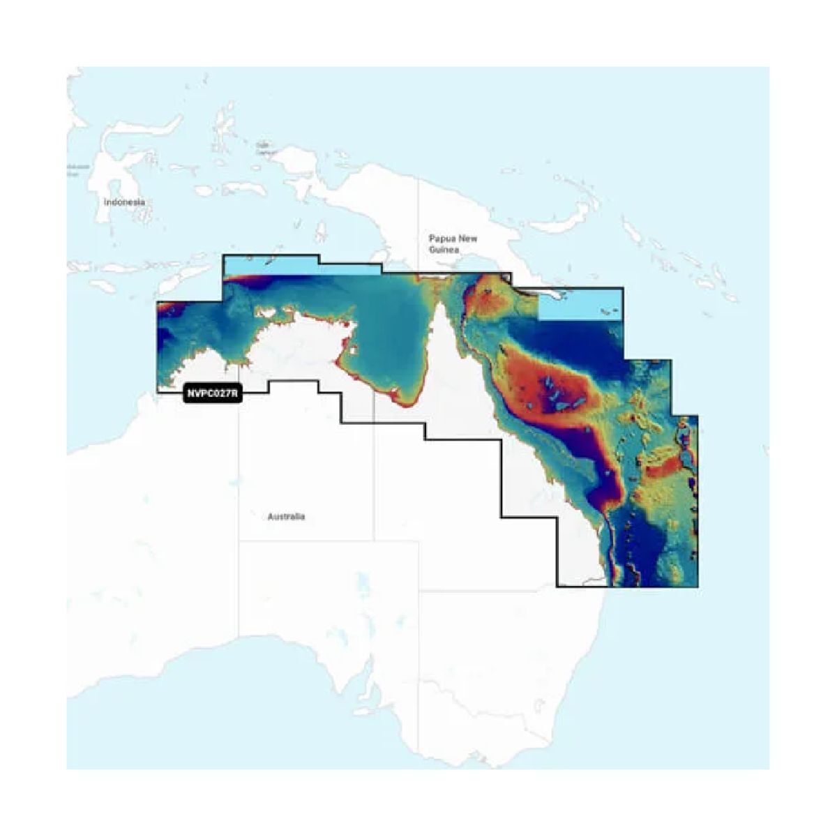
Garmin Navionics Vision+ Australia, Northeast - Inland and Coastal Marine Charts
Featuring vibrant colours, a streamlined interface and combined coastal/inland content with a popular Navionics® style colour palette, Garmin Navionics+ cartography makes it easy to plot your course with the world’s No. 1 name in marine mapping.
SKU: GAR.010-C1281-00 | MPN: 010-C1281-00
SAVE $39.70 (10%)
Special OrderSpecial Order from Supplier

RELIEF SHADING
This downloadable shading feature4 combines color and shadow to give you an easy-to-interpret, clearer view of bottom structure than contour lines alone.
HIGH-RESOLUTION SATELLITE IMAGERY
Downloadable high-resolution satellite imagery4 provides superior situational awareness.
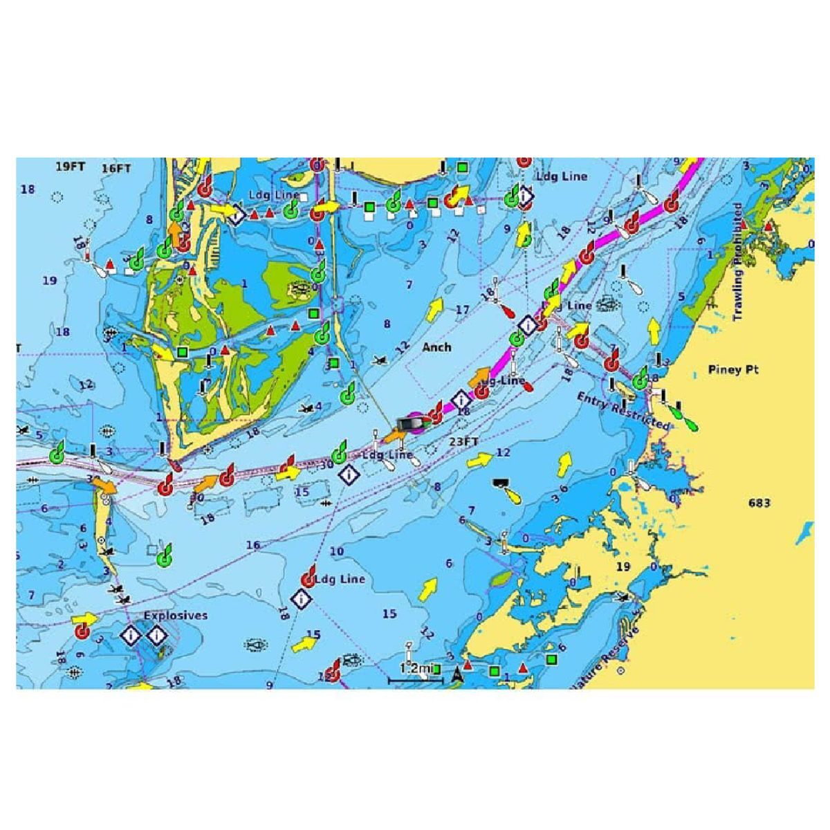
AERIAL PHOTOGRAPHY
Crystal-clear aerial and surface photos of ports, marinas, bridges, docks, boat ramps, dams and navigational landmarks provide a better sense of your surroundings above the waterline.
3D FISHEYE VIEW
This underwater perspective shows 3D representation of bottom and contours as seen from below the waterline. Interface with sonar data for a customised view.
3D MARINEREYE VIEW
This view provides a 3D representation of the surrounding area both above and below the waterline.
DYNAMIC LAKE LEVEL
Adjust your maps to the lake’s current water levels to see if spots are accessible or too shallow to explore.
RELIEF SHADING
This downloadable shading feature4 combines color and shadow to give you an easy-to-interpret, clearer view of bottom structure than contour lines alone.
HIGH-RESOLUTION SATELLITE IMAGERY
Downloadable high-resolution satellite imagery4 provides superior situational awareness.
AERIAL PHOTOGRAPHY
Crystal-clear aerial and surface photos of ports, marinas, bridges, docks, boat ramps, dams and navigational landmarks provide a better sense of your surroundings above the waterline.
3D FISHEYE VIEW
This underwater perspective shows 3D representation of bottom and contours as seen from below the waterline. Interface with sonar data for a customised view.
3D MARINEREYE VIEW
This view provides a 3D representation of the surrounding area both above and below the waterline.
DYNAMIC LAKE LEVEL
Adjust your maps to the lake’s current water levels to see if spots are accessible or too shallow to explore.
| SKU | GAR.010-C1281-00 |
| Model # | 010-C1281-00 |
| UPC/EAN | 753759290559 |
| Brand | Navionics |
| Shipping Weight | 0.0200kg |
| Unit Of Measure | ea |
Be The First To Review This Product!
Help other Outback Marine Australia Pty Ltd users shop smarter by writing reviews for products you have purchased.